Main Menu Labelling Interface Rules
Rule 12
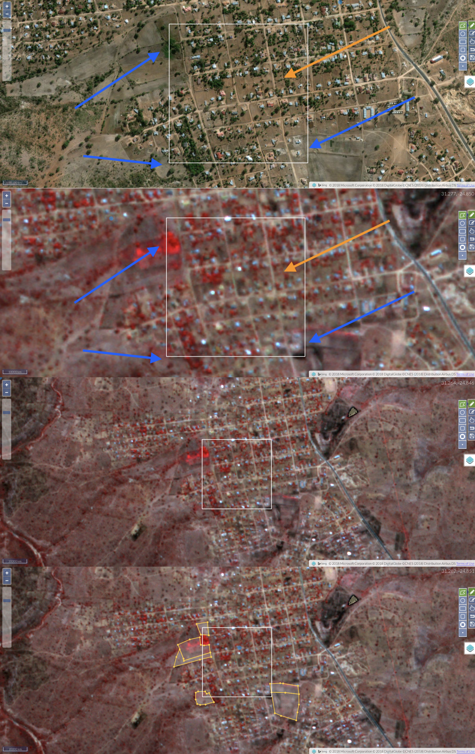
Don’t label fields within urban neighborhoods
They tend to be too small to detect with Planet imagery, and may just be yard. However, there are fields along the peripheries of urban areas that are large and obvious to label, and there are often fields adjacent to houses in rural settlements. Please do label these.
Here’s an example over a town in South Africa. The orange arrows show within neighborhood plots that look agricultural, when viewing the basemap. However, they can’t really be seen in Planet data (an off-season false color image is shown here). The blue arrows show some more obvious fields on the neighborhood’s boundaries that intersect our labelling target. These should be labelled as we show in the bottom panel.