Main Menu Labelling Interface Rules
Rule 6
Update: Do not label tree crops. If we were labelling tree crops, you would choose the tree crops category if the field looks like it contains trees or woody shrubs.
Tree crops are different from annual croplands as they consist of long-lived, typically woody species that are typically grown for many years. They include everything from fruit-tree orchards (e.g. orange, mango) to coffee and cocoa plantations, to woodlots and other types of timber plantations.
Here are some guidelines for recognizing tree crops.
Guideline 1: Tree crops are distinguished from annual croplands and unmanaged/natural woodland and shrubland based on density and regularity
As mentioned at explained in Rule 5, tree crops have higher density than annual croplands containing trees (e.g. agroforestry) . They can be distinguished from natural or unmanaged woodlands and shrublands by having generally regular size and spacing. It can be particularly helpful (and sometimes essential) to look at the basemap to confirm the presence of a tree crop.
Let’s refer back to the example from Rule 5. There are four tree crops that we can see in it, which we verify by comparing to the basemap. Note that differences between the basemap and Planet images may be less with tree crops because they aren’t harvested as frequently.
Guideline 2: Tree crops can vary in height and density. Shorter or younger tree crops may be easily confused with annual cropland. Taller tree crops may be easily confused with surrounding natural/unmanaged vegetation
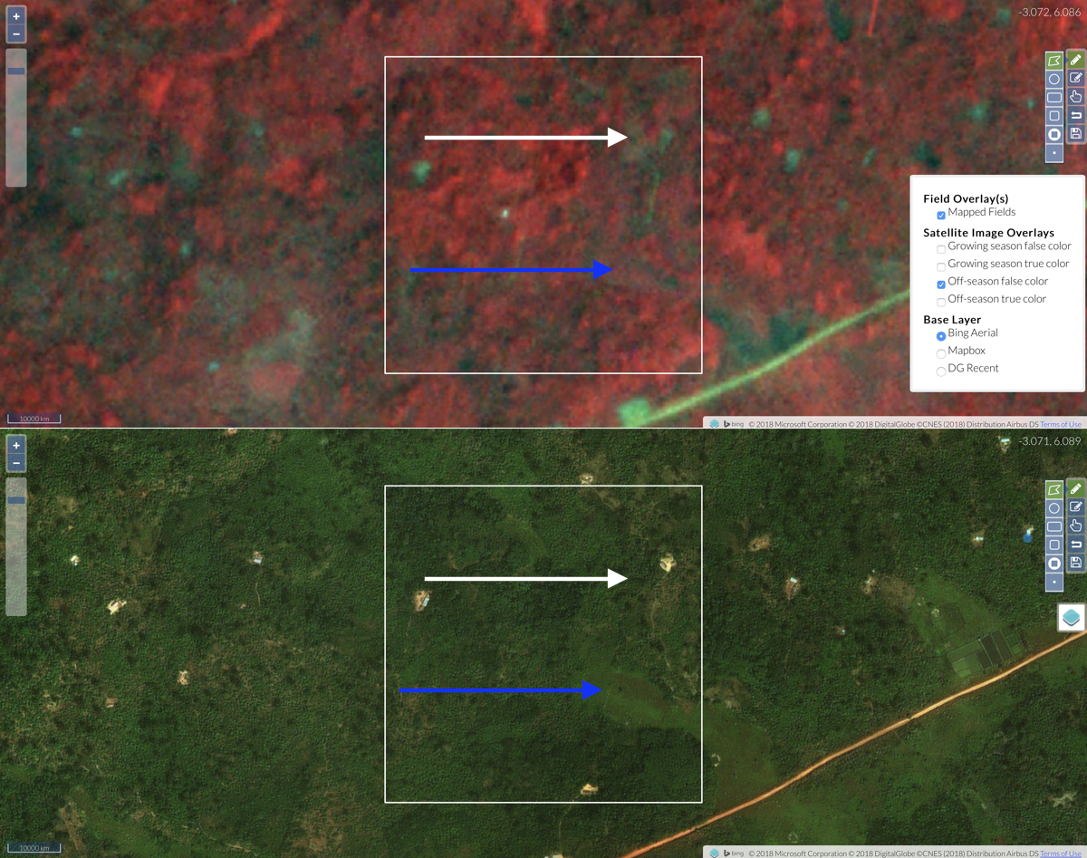
The example below shows what appears to be a young orchard, as indicated by the blue arrows. The orchard trees are small and widely spaced, and really only visible in the basemap.
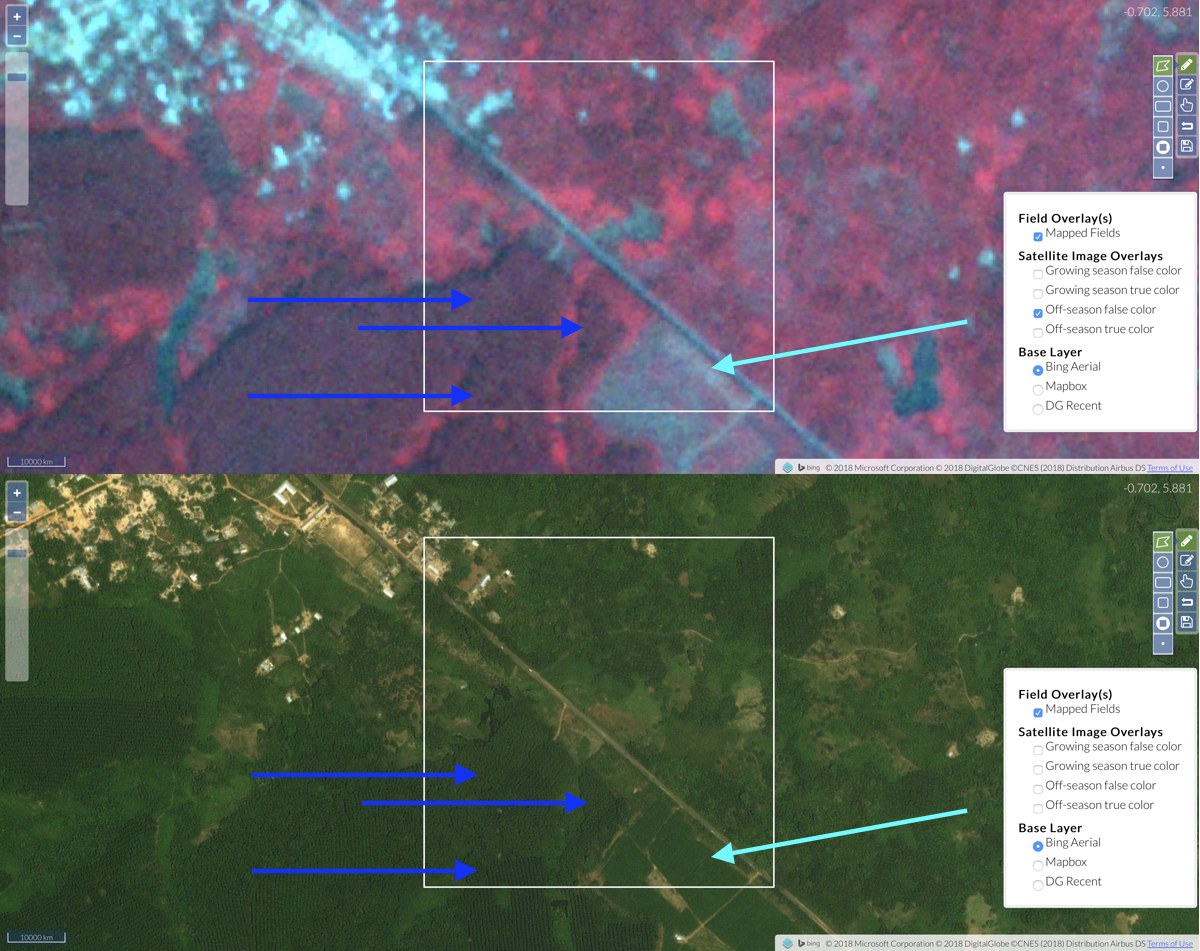
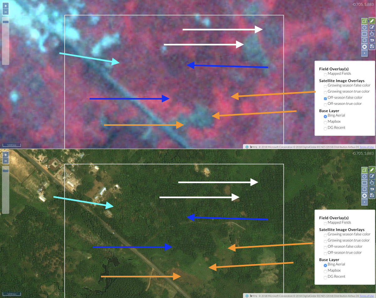
The next location is even more complicated. This image contains a mix of different tree crops and annual croplands. The blue arrows indicate mature stands in a rubber plantation (we know because we have been there!). The light blue shows a young rubber compartment. It looks like it might be cleared in the Planet image, but that might be because the image in question was taken in the off-season. Note again that interpretation against the basemap is important.
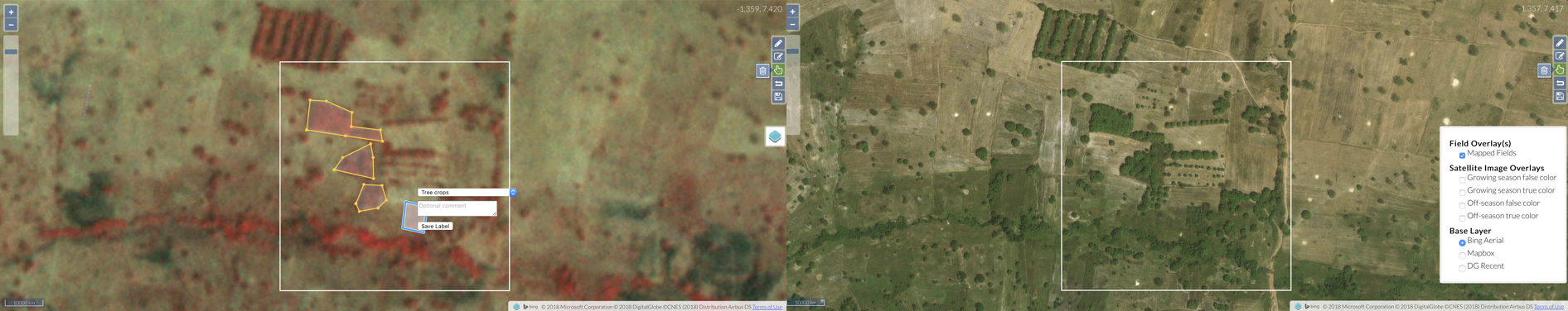
It gets even more complicated in this scene when you zoom in to the upper part of the target (below).
- First, the orange shows indicate some annual croplands, which appear to be clearings.
-
The darker blue arrows point out oil palm plantations (a tree crop). You can see they have quite a distinctive appearance when seen in the basemap.
-
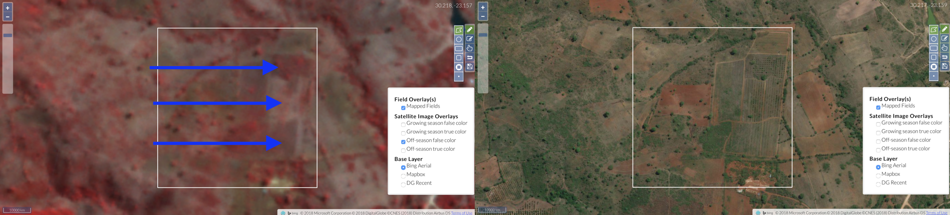
The white arrows also point out oil palm, however, in this case, the oil palm visible in the basemap appears to have been harvested before the Planet image was captured, as the false color image looks like an annual cropland. Label this area as annual cropland, since it looks to the classifier more like annual cropland, and it could well be replaced by annual replaced.
- The cyan arrow points out what appears to be cocoa (a tree crop), which has a brighter green (in the basemap) and somewhat more uniform appearance than the oil palm.
Guideline 3: Some tree crops blend into the landscape, and look more like unmanaged bush, woodland, or forest.
That is fine, because we are not trying to label these anyway, but helpful to know (as we will try to label these at a future point). For example, cocoa crops in Southwestern Ghana. The boundaries blend into one another, making it hard to separate from the surrounding forest, even if you are looking just at the basemap. In these types of areas, you should just label clearings and annual croplands, like those shown with blue and white arrows. Note that the white arrow indicates a clearing that occurred after the basemap image was taken. We can classify that as annual cropland.